Varied habitats are required to support values in rivers, wetlands and estuaries
Waterway habitat covers a broad range of habitat condition, from aspects of physical form such as erosion and bank stability, to instream connectivity along the waterway to allow fish passage, to floodplain connectivity and the protection of specific habitat to support key species.
Values supported by the condition of habitat
Macroinvertebrates, fish, frogs, birds, platypus and vegetation
Habitat condition impacts all of the environmental values.
Excessive bank erosion can lead to increased sediment loads and reduction in water quality, smothering aquatic vegetation, and threatening fish and macroinvertebrates. Unstable banks reduce riparian vegetation.
Trees naturally fall into waterways and provide important habitat for macroinvertebrate, platypus and fish populations. Large wood and rocks around wetlands provide places for frogs to bask and shelter from predators.
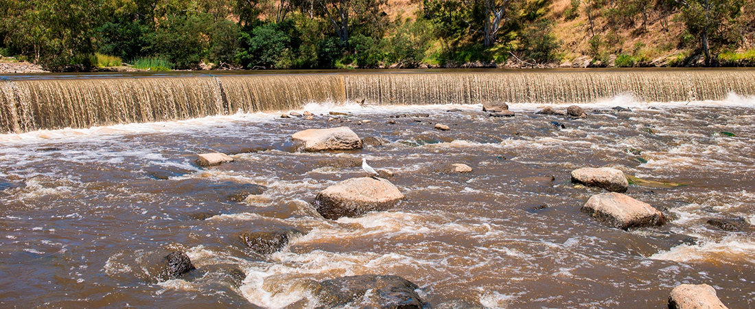
Dams, reservoirs, weirs, culverts, and pipes can impede the ability of fish to travel through the waterway network, fragmenting populations, disrupting migratory patterns and restricting access to food and habitat.
Loss of connectivity between estuaries and their associated wetlands reduces the ability of the wetlands to support numerous shorebirds and other environmental values. Rock walls, levees and other infrastructure can prevent water from the estuary connecting to these wetlands.
Fresh and estuarine wetland habitat can be further impacted through reduction in wetland area as a result of altered water regime and/or physical disturbance through excavation, grazing or development activities. Reduced wetland extent and disruption means less habitat for frogs and birds.
Amenity, recreation and community connection
Aspects of the physical form of rivers impacts on amenity and the sense of ‘naturalness’ the waterway provides. People are more likely to value a natural channel with stable banks, meanders, pools, and riffles, than a concrete or straightened channel. The naturalness of the waterway form is often a drawcard when it comes to choosing places for recreation and community connection.
2022 Case study: Checking in to the Fish Hotel
'Fish hotels' improve river health by reintroducing complex woody habitat into the waterway to benefit native fish and provide new recreational fishing opportunities. A partnership of key agencies has been implementing fish hotels in the Maribyrnong River Estuary.
Habitat is measured using similar, but different components for rivers, estuaries and wetlands
For rivers, the habitat condition encompasses physical form and instream connectivity. Riverine physical form includes the bed and bank composition, large woody debris, and riparian rock habitat. These factors support environmental values through provision of diverse habitat. Riverine instream connectivity is the ability of fish to travel through a stream network.
Estuary habitat condition includes longitudinal extent and estuarine wetland connectivity. Estuarine longitudinal extent is a measure of estuaries that are affected by constructed barriers that interfere with the movement of water and fish, and the extent of the salty estuarine habitat. Estuarine wetland connectivity is a measure of the connection between the estuary and associated wetlands.
Wetland habitat form considers the extent that wetland size has been reduced and alterations made to the wetland depth. Wetland size and depth can be reduced through levees and diversions, or altered through excavation, physical displacement, grazing or other development activities. Wetland size and the range of shallow and deeper water affects how much habitat is available for birds and frogs.
Measuring habitat condition
Habitat condition is measured in a variety of ways for different purposes. Physical form, in-stream and wetland connectivity and wetland habitat are measured through a range of indicators including; erosion potential, analysis of fish barriers and whether they are full or partial, analysis of estuarine wetland connectivity and wetland physical form measures. More on the rationale for the metrics and condition assessment can be found in the Rivers, Wetlands and Estuaries Monitoring and Evaluation Plans.
Information collected on physical form, connectivity condition, extent and area over the life of the strategy will inform the evaluation of waterway condition, undertaken mid-way through the strategy and at the end of the strategy to inform the strategy evaluation and revision.
Habitat condition baseline and targets
In rivers
2018 baseline:
Riverine physical form is based on an erosion potential index score.
Riverine instream connectivity is based on an average of the proportion of the stream with connectivity to the outlet (i.e. Port Phillip or Westernport Bay) and the proportion of the stream length with fish passage at sub-catchment scale.
2068 target:
The targets represent what can be achieved with a coordinated, collaborative and prioritised effort to improve physical form and connectivity in rivers, in line with the level of investment over the past 15 years. The physical form target assumes that trees will fall into the water naturally, improving large wood in streams and wetlands over time. The connectivity target assumes some barriers associated with large dams are likely to remain over the 50-year time frame.
Without continued investment in enhancing and maintaining habitat in rivers, the physical form condition will decline as erosion potential increases due to drier conditions, loss of vegetation, and flashier flow due to extreme events and urbanisation. Connectivity will stay the same as the barriers to movement will remain.
Number of rivers in each catchment by habitat condition score
Hover, click or tap (on mobile) the charts below to view more information.
Physical form - Baseline and trajectories in Rivers
Instream connectivity - Baseline and trajectories in Rivers
In estuaries
2018 baseline:
Estuarine longitudinal extent is scored based on % of the estuary extent impacted by an artificial barrier.
Estuarine wetland connectivity is scored as the percentage of estuary perimeter that has artificial structures (such as seawalls, levee banks, jetties, bridges, platforms etc.).
2068 target:
The targets represent what can be achieved with a coordinated, collaborative and prioritised effort to improve estuarine wetland connectivity and longitudinal extent conditions.
Without intervention, the trajectory for estuarine wetland connectivity varies depending on whether the estuary is in rural or urban land. Estuarine wetland connectivity on rural land may improve if estuaries can migrate inland but in urban catchments opportunities for migration are constrained. Longitudinal extent is expected to improve for all estuaries as sea-level rise and more frequent storms will mean any existing barriers such as weirs may be overtopped more frequently.
Number of estuaries in each catchment by habitat condition score
Wetland connectivity - Baseline and trajectories in Estuaries
Longitudinal extent - Baseline and trajectories in Estuaries
In wetlands
2018 baseline:
Wetland habitat form is based on the change in wetland area derived from the Index of Wetland Condition Physical Form and Soils sub-indices.
2068 target:
The targets represent what can be achieved with a coordinated, collaborative and prioritised effort to improve wetland habitat form. The assumption is that over the long term, wetland habitat form on alluvial plains could be maintained or improved to moderate, but wetland habitat form on the basalt plains is anticipated to be maintained or slightly improved but still remain low due to pressures of climate change and urban development.
Without intervention, habitat form for wetlands on the basalt plains is predicted to decline due to altered hydrology driven by reduced rainfall and urban growth. On the alluvial plains, it is predicted to improve for some sites that have a stable water regime, while others maintain their current condition. Habitat form for coastal wetlands in Western Port is predicted to improve or decline depending on opportunities for wetland migration inland due to climate change.
Number of wetlands in each catchment by habitat condition score
Habitat form - Baseline and trajectories in Wetlands
Actions that improve habitat condition of waterways
There are a range of actions to improve habitat conditions in rivers, estuaries and wetlands.
Mitigate threats to physical form (habitat)
Threats to physical form may include erosion, impacts of urban development, effects of pest animals, and climate change. For estuaries, this also includes disruption of acid sulphate soils.
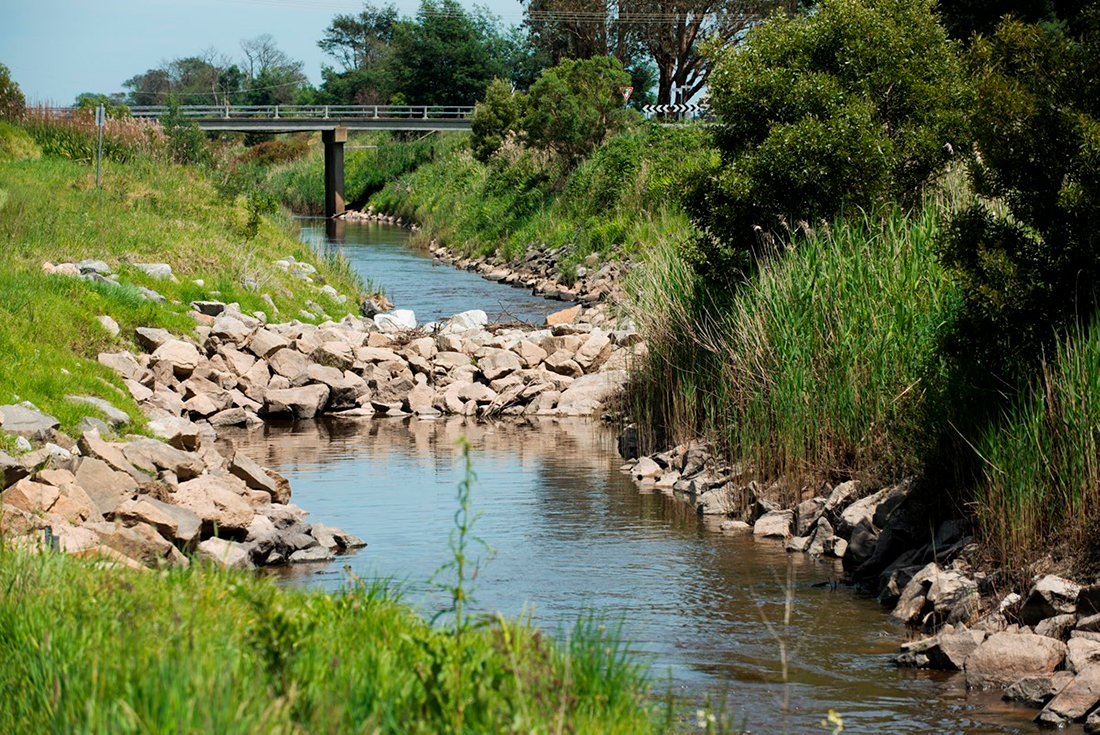
Actions in the strategy include investigating and mitigating erosion in rivers, maintaining erosion control structures, and ensuring estuary mouth openings consider acid sulphate soils.
Improve fish passage
Improvement of fish passage involves either removing the barrier entirely or adding infrastructure to allow fish passage through fishways.
In the strategy, actions include the removal of priority fish barriers to improve the extent of habitat for fish. Another key action is to maintain existing fishways so that they continue to function effectively. This is covered under regional performance objective RPO-18 of the Report Card.
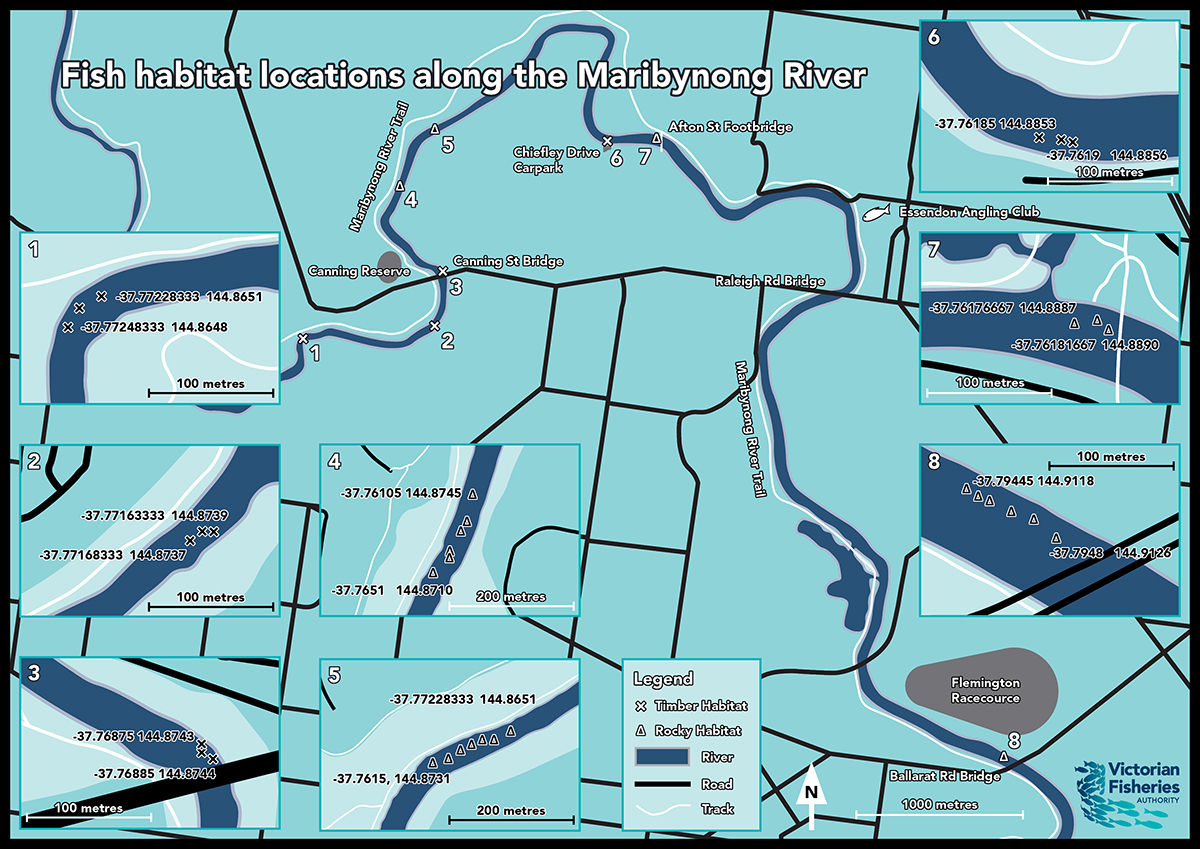
Explore fishways and fish barriers for removal on the map >>
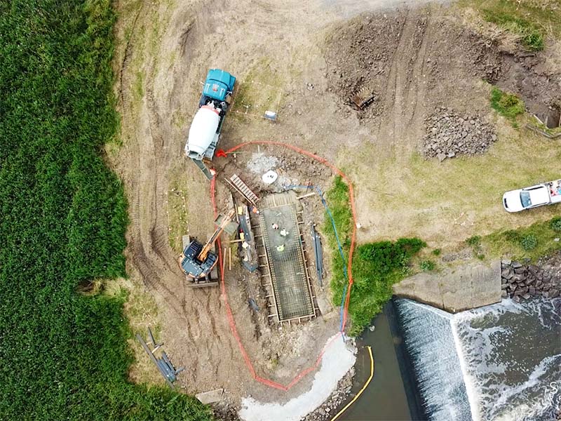
2021 Case study: Improving fish passage in Dandenong Creek
A new fishway has been built to support native fish to swim more freely between Port Phillip Bay and the waterways of the Dandenong Creek catchment.
Protect specific habitat
Protecting specific habitats is important ensuring habitats for rare and threatened species or vegetation communities are prioritised and key areas for breeding and roosting are protected.
In the strategy, actions include mitigating threats to important habitats for key species, protection of Dwarf Galaxia and Southern Toadlet habitat as well as roosting sites in estuaries. It also includes regional performance objective RPO-28 to identify and manage Seasonal Herbaceous Wetlands and RPO-32 to protect and enhance sites of biodiversity significance associated with the region's waterways.
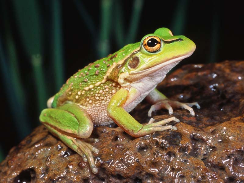
2021 Case study: Building high quality habitats for Growling Grass Frogs
It’s exciting to report that young Growling Grass Frogs are already being found in the first wetlands to be purpose-built for this iconic, endangered species.
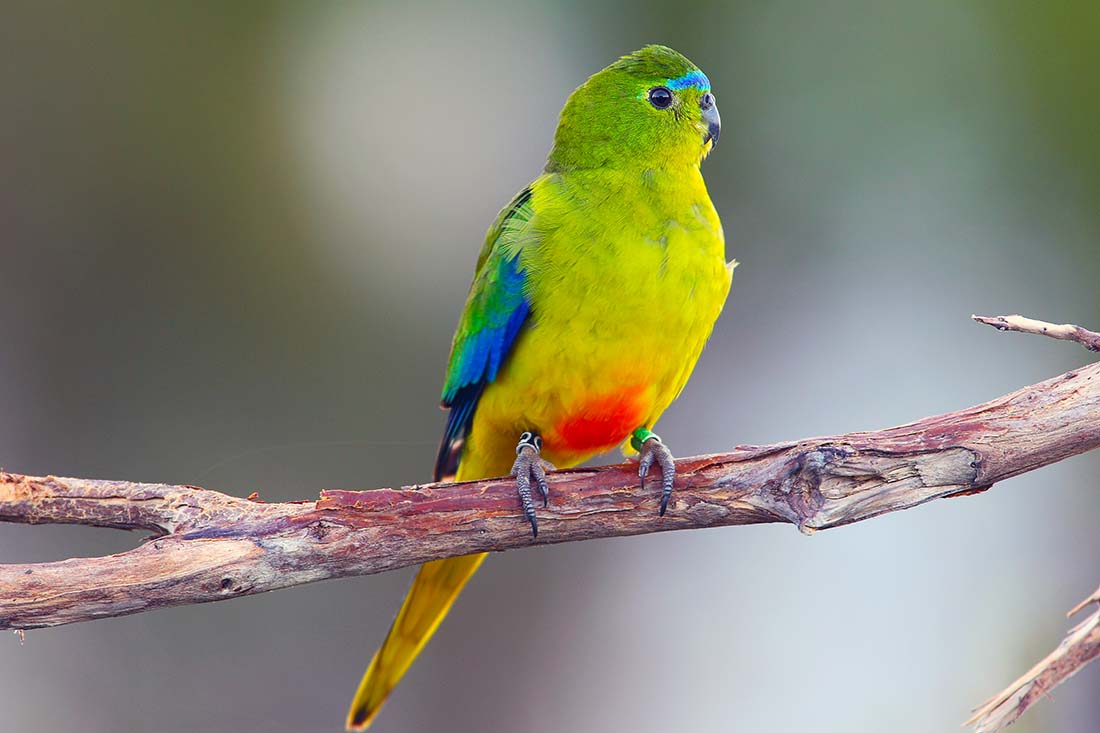
2021 Case study: Efforts to help the Orange-bellied Parrot
Orange-bellied Parrots (OBPs), a critically endangered species, are successfully being bred and released into the wild in the hope of increasing the wild population of this iconic species. Efforts are also being made to protect and restore habitats for the OBP such as coastal salt marsh on the northern shores of Port Phillip Bay.
Re-engage floodplains
Re-engaging floodplains improves connectivity and biodiversity in billabongs and estuarine wetlands and will allow estuarine habitats to migrate in response to climate change. In the strategy, actions include investigating opportunities for re-engagement of the floodplain in the Middle Yarra.
Manage pests
Pests such as deer, rabbits, carp and other species can cause disturbance to habitat through excess trampling and grazing, stirring up sediments, and burrowing. In the strategy, pest animal control adopts a risk-based approach to prevent, eradicate and contain pest plants and animals including woody weeds, deer and rabbits to protect vegetation in priority areas.
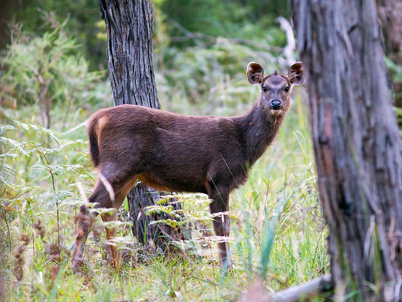
2021 Case study: Deer, oh dear!
Deer continue to be a key threat to vegetation, habitat, agriculture and safety across the region but momentum is building to tackle this pest in a coordinated way.