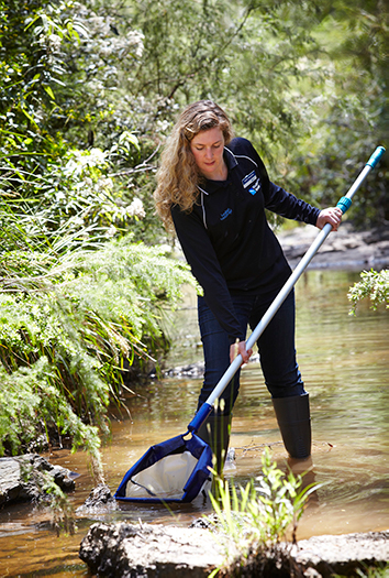
Macroinvertebrates are a good indicator of river health
Aquatic macroinvertebrates are small animals without a skeleton that live in the water for at least part of their life cycle. Macroinvertebrates are found in rivers, estuaries and wetlands. There are thousands of aquatic macroinvertebrate species and they are a key food source for platypus, fish, and frogs. There are several species of macroinvertebrate unique to our region, such as the Dandenong amphipod, that are particularly important to the community.
Macroinvertebrates are measured using the LUMaR index
The Healthy Waterways Strategy used a new macroinvertebrate index developed for the region known as the Land Use Macroinvertebrate Response (LUMaR). The LUMaR index is more suitable for measuring waterway condition in our region than previous indexes such as SIGNAL 2 because it is more sensitive to moderate levels of degradation and better accounts for the variation in expected species across the region. For example, there are significant differences in expected species between the rivers in the west and east of the region due to rainfall patterns.
Calculating the LUMaR index involves comparing the macroinvertebrate community present with what would be expected if the community were in good condition (an observed to expected ratio). Scores range between 0 and 1 with a score nearer to one meaning the waterway is in very good health as all or almost all expected macroinvertebrate families are present.
Macroinvertebrate monitoring sites are generally surveyed annually with some sites having both spring and autumn samples. Graphs in the trends section below will be updated as new data becomes available. Changes over time are analysed statistically at each site when enough data is available.
Macroinvertebrates are currently only assessed in rivers. Indexes of macroinvertebrate health for wetlands and estuaries are being developed and will be incorporated over the life of the strategy.
The macroinvertebrate data, trends and model outputs will be used during the mid-term and final evaluation of the Healthy Waterways Strategy to understand macroinvertebrate health.
Trends in macroinvertebrate condition
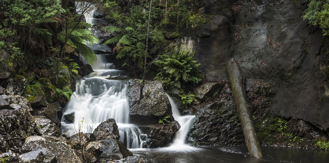
In our region, healthy populations of macroinvertebrate are most often found in the forested upper catchments and condition generally decreases as land use changes and urbanisation pressures increase.
A trend line shows the changes over time at a site and is helpful for determining whether the health of the macroinvertebrate population is stable, declining or improving. If a site or a group of sites declines from one LUMaR category to another (e.g. from high to moderate) it will become the focus of further evaluation to determine what actions are needed to address the decline.
In the 2019-20 financial year, no category changes in LUMaR scores were detected at any of the macroinvertebrate sites.
Below is a summary of macroinvertebrate data for key land uses across the region.
Hover, click or tap (on mobile) the charts below to view more information.
All sites in the forested catchments have high or very high LUMaR scores. Most sites are very stable and resilient and can recover relatively quickly from periods of stress such as drought and bushfire.
There are 27 monitoring sites in the forested catchments; 17 in Yarra, two in Maribyrnong, six in Werribee, one in Dandenong and one in Westernport. Of these 18 have enough data to report trends over time.
Macroinvertebrate assemblages in Aldermans Creek at Track 32 Yarra Ranges National Park (Site ID ALD-2608-1) have been consistently diverse over the last 25 years, indicating very good condition and showing resilience to the drier period associated with the Millennium Drought.
Sites in rural catchments typically show less diversity than forested sites primarily because of agricultural impacts such as land clearing that has degraded riparian zones and increased nutrient and sediment run-off. Macroinvertebrate assemblages can be quite variable between sites in rural areas which is an indication of the variation in different types of agricultural and land management practices.
There are 63 sites being monitored in predominately rural catchments across the region; 17 in Yarra, 16 in Maribyrnong, 15 in Werribee, one in Dandenong and 14 in Westernport. Of these 29 have enough data to report trends over time.
While macroinvertebrate assemblages in the Yarra River near the Healsville-KooWeeRup Rd, Yallock (Site ID: YAR-112355-4) are relatively stable and in good condition, they have declined from the forested sections further upstream. Sites like this on the main stem of a river were more resilient during the Millennium Drought compared with smaller creek tributary.
Macroinvertebrate assemblages in the Lang Lang River upstream of Drouin-Poowong Road, Athlone (Site ID: LNG-16600-6) are more degraded and variable over time illustrating that rural sites can vary significantly.
Macroinvertebrates in urban catchments are typically in poor condition because of the many impacts to stream condition that result from urban development with conventional directly-connected stormwater drainage. However, waterway health in urban catchments where significant stormwater interventions to have taken place are starting to show signs of recovery, demonstrating that improved stormwater control can protect condition.
There are 30 sites being monitored in urban or urbanising catchments across the region; 10 in Yarra, nine in Maribyrnong, two in Werribee, seven in Dandenong and two in Westernport. Of these, 19 have enough data to report trends over time.
Macroinvertebrate assemblages in the Yarra River Lower near Fitzsimons Lane, Templestowe (Site ID: YAR-275352-4) were in good condition until the 1990’s when urban development in the catchments of the Mullum Mullum, Diamond, Brushy and Olinda Creeks increased significantly.
Macroinvertebrate assemblages in the Dandenong Creek upstream of Boronia Road, Wantirna (Site ID: DNG-7957-4) have been in poor to very poor condition since at least the mid-1990s as this catchment was urbanised well before that. The stream supports only a small number of macroinvertebrate species that are tolerant to the flow and pollution disturbances arising from the stormwater drainage network of the mixed residential and industrial suburbs of Wantirna, Bayswater and Kilsyth South.
Macroinvertebrate assemblages in Dobson's Creek upstream of Basin-Olinda Road, Sassafras (Site ID: DBS-363-4) have improved as a result of concerted effort to introduce dispersed stormwater control measures in The Basin. Dispersed stormwater controls combined with wide, well vegetated riparian zones can protect waterways from many of the impacts of development.
As urban growth continues, preventing waterway decline is preferable and more cost effective to the community than rehabilitation. Implementation of the stormwater targets in the Strategy should start to halt the decline in priority areas. A number of sites around the Sunbury development are being carefully monitored to assess the effectiveness of higher stormwater requirements on urban development. These will be reported when enough data is available.
Data available for download
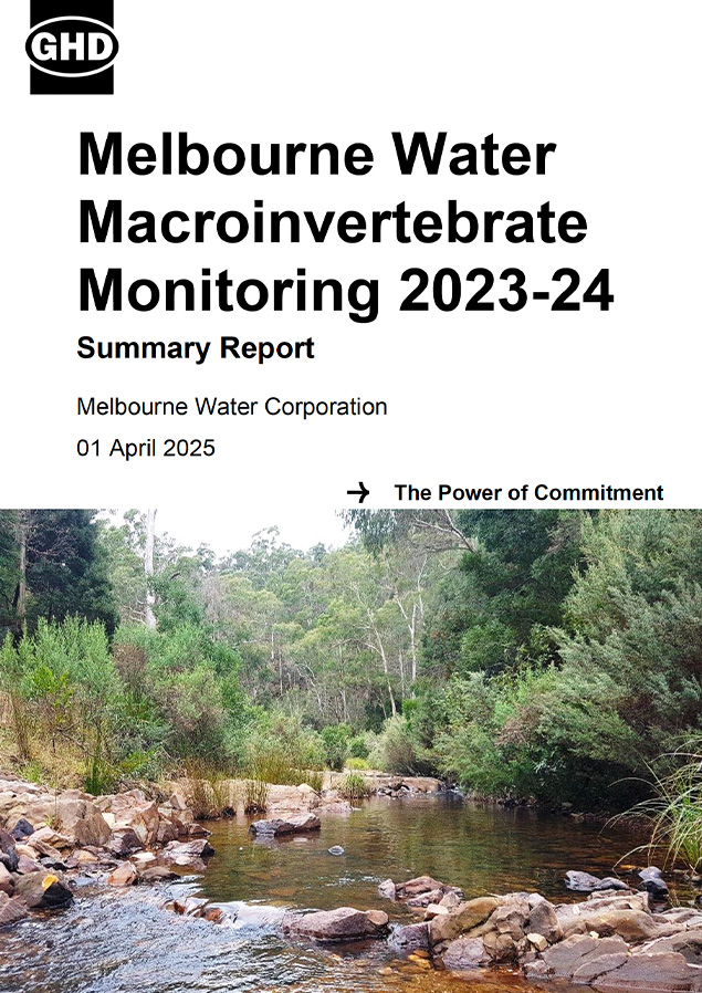
Melbourne Water Macroinvertebrate Monitoring 2023-24 Summary Report
Macroinvertebrate health baseline and targets
2018 baseline: the condition of macroinvertebrates was measured in 2018 using habitat suitability models developed using macroinvertebrate data and a range of other region-wide data sets such as mean annual run-off and vegetation cover.
2068 target: the target represents where we want to be in 50-years and is what can be achieved with an increase in coordinated, collaborative and prioritised effort. It is the scenario that the strategy co-design partners have agreed is needed. The ‘target trajectory’ includes assumptions about policy and other mechanisms being in place to support increased standards for stormwater management, increased resources for waterway management, willingness to take collaborative actions and that it is feasible to establish continuous vegetation buffers along most waterways.
Without additional coordinated effort, the condition of key values, including macroinvertebrates across the majority of the region’s waterways are expected to decline, primarily because of climate change and urbanisation. Even with the existing effort and resources of waterway managers, agencies and community, it will be extremely difficult to maintain all the waterway values everywhere. This knowledge provides a definitive call to action, and confirms that aligned, increased and collaborative efforts will be needed over the next 10 years.
Macroinvertebrate populations will take some time to respond to environmental changes that are brought about through attaining the performance objectives. It may not be possible to detect improvements in macroinvertebrates over the 10-year timeframe of the strategy. However, evaluation and reporting of macroinvertebrate data will be undertaken to inform progress at mid-term and towards the end of the Healthy Waterways Strategy.
Habitat suitability modelling outcomes for the 2018 baseline and the long term targets for each sub-catchment can be viewed on the Strategy map. For more information on the habitat suitability models and the monitoring program rationale see the Healthy Waterways Strategy Resource Document and the Monitoring and Evaluation Plan for Rivers.
Number of waterways in each catchment by macroinvertebrate health score
Hover, click or tap (on mobile) the charts below to view more information.
Baseline and trajectories in Rivers
Conceptual models show the links between conditions in the river and macroinvertebrates
Conceptual models are a summary diagram that illustrate which environmental conditions are most important for the health of macroinvertebrates communities. In the diagram below they also show which conditions are most affected by climate change and urbanisation. Actions that can improve environmental conditions are linked via box colours.
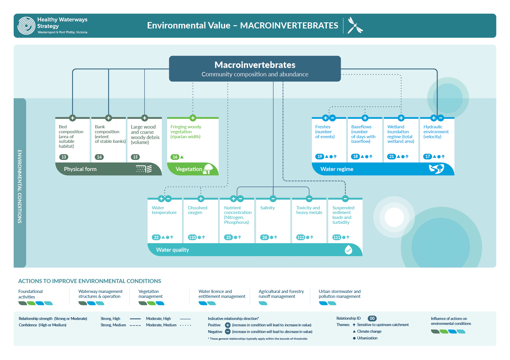
Download the macroinvertebrates conceptual model 314 KB (PDF)
More information on the conceptual models can be found in the Healthy Waterways Strategy Technical Resource Document.
Changes in waterway conditions can have a big impact on macroinvertebrate health
The conditions that influence macroinvertebrates are described below. Some of the more important ones are monitored over time so that we can track whether actions taken in the strategy are leading to improvement.
Physical form
Macroinvertebrate populations are healthiest in streams where habitats are diverse. Stable, well-vegetated river banks, mixtures of coarse and fine rocks and pebbles on the stream bed and a variety of riffles and pools provide different habitats that suit a diverse range of species. Large logs and branches in rivers and wood and leaf debris adds to in-stream habitat diversity and many macroinvertebrates are found living on and around these.
Macroinvertebrate scores are lower where in-stream habitat is less diverse. This can be the result of human impacts such as land clearing and stormwater inflows resulting in increased bank erosion, silt run-off from urban development and agriculture settling over the stream bed and fallen trees being removed from waterways.
Physical form is considered under the habitat condition. See waterway conditions - habitat for more details on how the physical form of waterways is monitored.
Vegetation
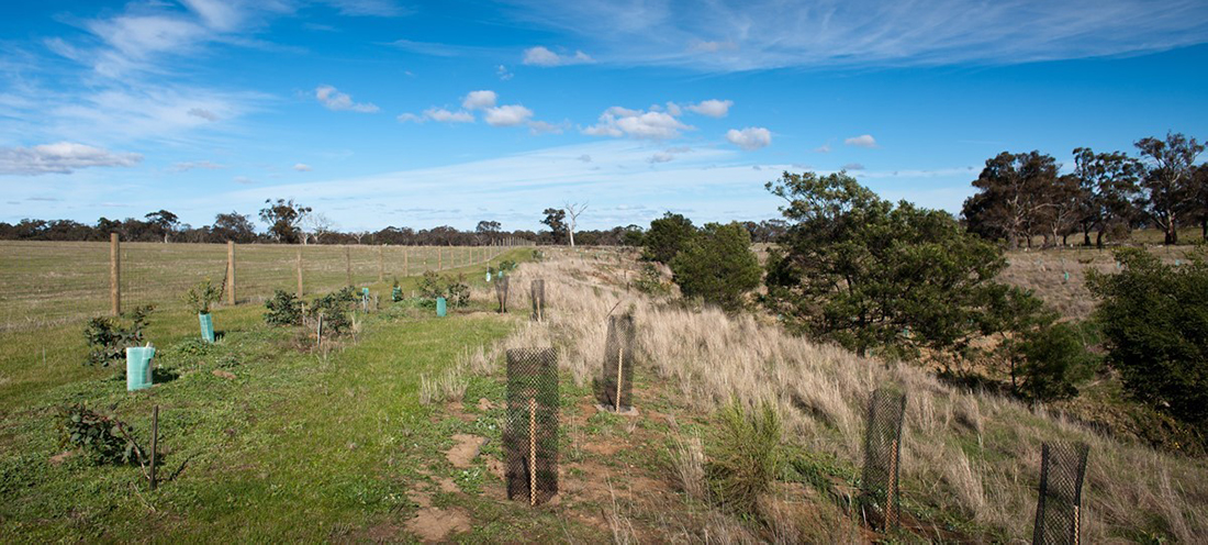
Wide, well-vegetated waterway corridors support healthy macroinvertebrate communities. Vegetation provides habitat, shade and food sources. Land clearing for agriculture or urbanisation will often reduce the width and continuity of the riparian vegetation. This significantly impacts the health of macroinvertebrates and the overall health of the waterway.
See waterway conditions - vegetation for more details on how this condition is monitored.

Water regime
The presence of water is essential habitat for macroinvertebrates. A variety of flows of different intensity and duration provide the best environment to support a diverse range of species. Naturally, rivers, wetlands and estuaries experience a variety of flows corresponding to periods of high and low rainfall. Native macroinvertebrates are accustomed to dry spells that reduce flows to a minimum. Pulses of water (freshes) move sediment and leaf litter, provide additional habitat and support in-stream vegetation. Larger flows also maintain the shape and structure of the river bed and banks.
Urbanisation impacts the natural flow regime by dramatically increasing the frequency and volume of water that enters the stream when it rains and reducing the amount of water that seeps through the soil to provide base flow to waterways. Urban stormwater flows wash away macroinvertebrates and the instream habitat they need.
See waterway conditions water for the environment and stormwater for more details on how the water regime is monitored.
Water quality
Water quality has a significant impact on the types of macroinvertebrates that are found in the waterway. Macroinvertebrate populations are best where the water is clean and cool. Land clearance, agricultural run-off and urban stormwater, particularly from industrial areas, can result in higher nutrients, suspended sediment, and toxic chemicals entering the waterway. Poor water quality reduces the diversity of macroinvertebrates present.
See waterway conditions water quality and stormwater for more details on how these conditions are monitored.
Actions that improve the condition of waterways for macroinvertebrates
There are a range of actions that can improve the health of macroinvertebrates in waterways. More information on progress towards actions can be found in the Report Card.
Mitigate threats to physical form (habitat)
Protecting and enhancing habitat for macroinvertebrates includes reducing threats such as erosion. This could include targeting works to install rocks in stream beds and banks to reduce erosion hot-spots. It can also involve managing rivers to ensure a wide range of physical forms such as riffles and pools are present.
In the Strategy, actions such as identifying and mitigating important areas of erosion will protect physical form.
Establish buffers and maintain vegetation quality
Increasing vegetation extent and protecting high quality vegetation will improve and protect macroinvertebrates. Working with land owners to install fencing for stock exclusion and revegetating the waterway corridor will improve riparian vegetation over time. Controlling pests such as rabbits and deer is important for maintaining investment in vegetation.
In the Strategy, actions such as providing grants to private and public land holders for fencing and revegetation works in priority areas will improve vegetation condition for macroinvertebrates over time.
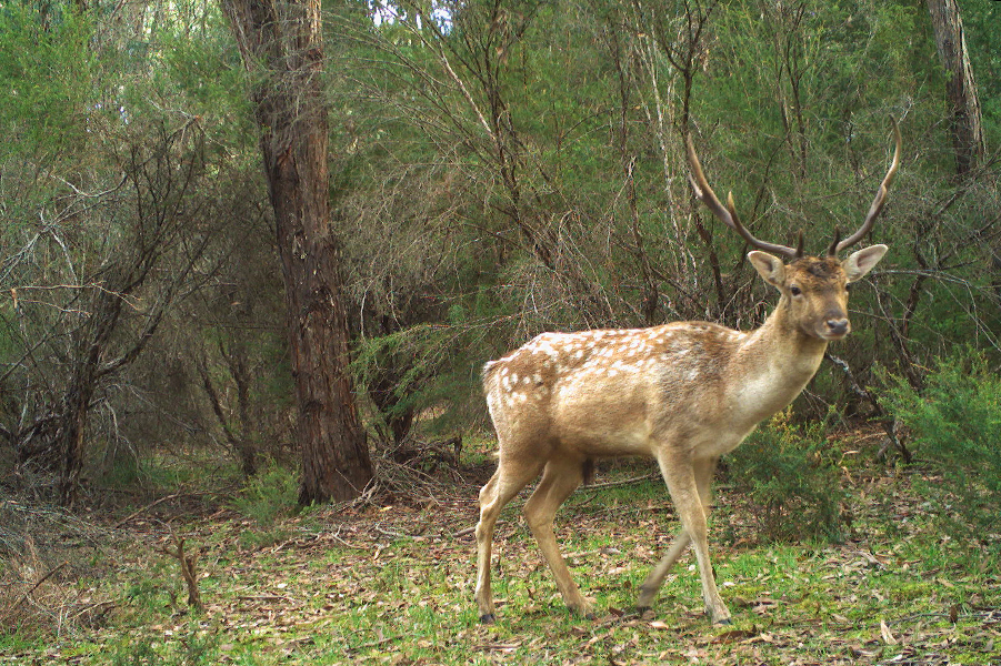
Case study: Putting the spotlight on deer control
Deer are a key threat to native vegetation and critical habitat across the region. Modelling to predict deer density and monitoring vegetation recovery will provide critical information to help protect high value areas.
Improve water for the environment
Rivers with large dams that supply water for irrigation and drinking water often have an allocation of water set aside for supporting environmental values. Increasing the allocation of water that can be released to mimic natural flows will support all of the environmental values, including macroinvertebrates.
In the Strategy, actions such as Integrated Water Management projects that provide substitute water for irrigation, the revision of the Central and Gippsland Sustainable Water Strategy (SWS) and improving low flows in unregulated waterways will support key environmental values.
Infiltrate and harvest stormwater
Reducing the direct connection of impervious surfaces such as roads and roofs to traditional stormwater pipes that drain water directly to rivers is a key action to protect macroinvertebrates and many other waterways values. To protect and improve rivers in urban areas most of the run-off from hard surfaces should be harvested for alternative uses such as irrigation. Additionally, some stormwater should be infiltrated into the soil e.g. through porous paving so that it slowly moves into the river and supports base-flow conditions.
In the Strategy, actions such as Integrated Water Management projects to harvest and infiltrate stormwater in priority urban areas will protect macroinvertebrates.
Reduce agricultural run-off, sewage treatment plant discharges and industrial impacts
Improving water quality is a key action to support macroinvertebrate health. Reducing turbidity, pesticide, and nutrient run-off through improved agricultural land management is a key action that supports river health. Managing sewage treatment plant discharges to rivers is important so they don’t increase over time as the population grows. Instead of being discharged, treated water can be used for other purposes uses such as irrigation. Managing the risk of industrial pollution through education programs, enforcement actions or improved stormwater controls will benefit macroinvertebrates.
In the Strategy, actions such as improving rural land management in priority areas and maintaining sewage treatment plant discharges will help to improve water quality for macroinvertebrates.
Engage communities
Supporting community groups and citizen science programs to promote a better understanding of macroinvertebrates in the community improves waterway literacy and increases participation in activities that protect waterways.
In the strategy, actions such as education and monitoring programs like Waterwatch will engage communities and increase participation rates over time.