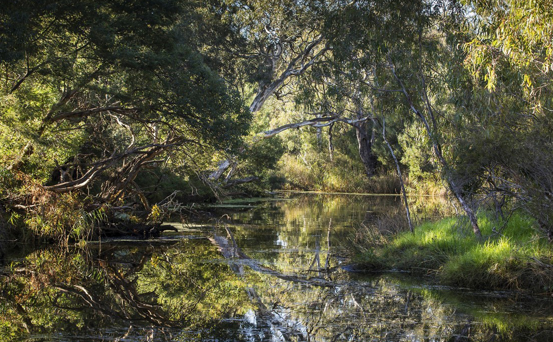
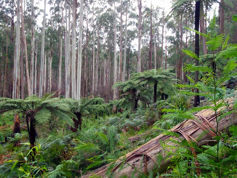
Vegetation along waterways is valued for many reasons
Vegetation as a key value encompasses the qualities of individual species and vegetation communities, some of which are rare and threatened. Vegetation also provides a valuable service to waterways, as habitat for other species or in providing shade to the waterway and the community.
Vegetation contributes to the sensory, aesthetic and ‘naturalness’ of waterways, which in turn supports community connection to the environment and to place.
Estuarine vegetation such as saltmarsh, mangroves and seagrass occurs closer to the coast. Many wetlands in the Melbourne region support rare and threatened vegetation species and communities. This includes Commonwealth Environment Protection and Biodiversity Conservation Act - listed Seasonal Herbaceous Wetlands and a range of vegetation communities and species of state significance.
Vegetation is both a value and a condition in the strategy. As a condition, vegetation has targets and is measured for the service it provides other values. Here vegetation is measured for its intrinsic value.
Vegetation is measured by its quality and extent
The measure of vegetation as a value uses the same method as vegetation condition plus an additional scoring for:
- existing areas of high-quality vegetation (Vegetation Vision 4 and 5) and the locally or nationally threatened species present in these areas,
- high priority reaches for other values such as platypus, birds and frogs, and
- presence of areas of drought refuge.
It is planned that vegetation indicators will improve over time by considering whether individual species or vegetation communities are rare or threatened both locally and nationally and whether they are listed under Flora and Fauna Guarantee Act 1988 or the Environment Protection Biodiversity Conservation Act 1999 in all river reaches, not just in existing high-quality areas.
An emerging and complementary method for monitoring vegetation condition over time using satellite imagery is being investigated in a research project with RMIT University. If successful this will enable vegetation condition to be monitored accurately at a broad scale and will improve the overall assessment of vegetation across the region.
Vegetation data will be used during the mid-term and final evaluation of the strategy to understand spatial and temporal trends of vegetation health across the region. Any development of new or improved indicators will be implemented after the mid-term review.
Vegetation baseline and targets
2018 baseline: The vegetation value for rivers was established using the same method outlined in vegetation condition with additional scores for protecting existing areas of high-quality vegetation containing rare or threatened species, high-value areas for other environmental values and drought refuge reaches. For wetlands, the Index of Wetland Condition, Melbourne Water’s Sites of Biodiversity Significance database and the Seasonal Herbaceous Wetlands assessment tool were used as well as presence of listed species under the Flora and Fauna Guarantee Act 1988 or the Environment Protection Biodiversity Conservation Act 1999 .
2068 target: the target represents where we want to be in 50 years and is what can be achieved with an ongoing coordinated, collaborative and prioritised effort. The target includes assumptions that all existing vegetation is maintained and that revegetation over the long term will achieve continuous vegetation along most waterways.
Without additional coordinated effort, the condition of vegetation is expected to decline overtime primarily due to threats such as urbanisation, and climate change. Even with the existing effort and resources of waterway managers, agencies and community, it will be extremely difficult to maintain all the waterway values everywhere. This knowledge provides a definitive call to action, and confirms that aligned, increased and collaborative efforts will be needed over the next 10 years.
Vegetation takes time to respond to actions measured through the performance objectives. It may not be possible to detect improvements to the vegetation value over the 10-year timeframe of the strategy. However, evaluation and reporting of vegetation data will inform progress at mid-term and towards the end of the Healthy Waterways Strategy.
Maps have been produced to show the vegetation extent and vegetation quality for the 2018 baseline and the long-term targets for each sub-catchment and of the vegetation performance objectives. For more information on the future monitoring program rationale see the Monitoring and Evaluation Plan for Rivers, Wetlands and Estuaries.
Number of waterways in each catchment by scoring category
Hover, click or tap (on mobile) the charts below to view more information.
Baseline and trajectories in Estuaries
Baseline and trajectories in Rivers
Baseline and trajectories in Wetlands
Conceptual models show the links between conditions in the river and vegetation
Conceptual models are a summary diagram that simply illustrate which environmental conditions are most important for the health of vegetation. In the diagram below they also show which conditions are most affected by climate change and urbanisation. Actions that can improve environmental conditions are linked via box colours.
Download the vegetation conceptual model (PDF 355 KB)
More information on the conceptual models can be found in the Healthy Waterways Strategy Resource Document.
Changes in waterway conditions can have a big impact on vegetation
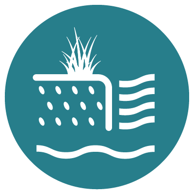
Physical form
The physical form of rivers, wetlands and estuaries has a strong relationship with vegetation. Physical form can be significantly impacted by clearing, stock accessing waterways and urban development. Streams in the past have been concrete lined or straightened to increase drainage capacity and manage flooding. Wetlands have been modified or fully or partially filled in through the process of urbanisation.
While small areas of erosion occur naturally along rivers, factors such as urbanisation and channelization can lead to severe erosion that washes away instream vegetation and causes bank failure and vegetation loss. Stock accessing streams tramples banks, damaging vegetation and creating localised erosion.
The depth and gradient of banks influences the suitable areas for different wetland vegetation types.
Physical form is considered under the habitat condition. See waterway conditions - habitat to see how physical form is monitored.
Water regime
Overbank flows and wetland inundation benefit many plants growing in wetlands, streambanks and on floodplains. However, inundation must occur at the appropriate time of year and for the appropriate duration - long enough to have a benefit but not so long as to not drown-out plants. Some long-lived species such as River Red Gum require periods of inundation for survival and recruitment of young seedlings. Pulsing flows or ‘freshes’ also have a positive effect on the condition of native aquatic and riparian vegetation by moving sediments, rewetting habitat and improving water quality. Preservation of base flows are critical to maintain growing conditions for aquatic and riparian vegetation.
See waterway conditions - water for the environment for more details on how the water regime is monitored.
Water quality
Water quality conditions that impact vegetation include the presence of nutrients, salinity, and suspended sediment. Increased nitrogen and phosphorus loads affect vegetation in two ways. Firstly, through promoting algae growth, which limits light to submerged plants and impacts on photosynthesis. Secondly, through increased exotic weed growth and competition with native vegetation. Salinity impacts on vegetation, and can alter community composition. Suspended sediment smothers instream vegetation and seagrass and inhibits growth.
See waterway conditions - water quality for more details on how these conditions are monitored.
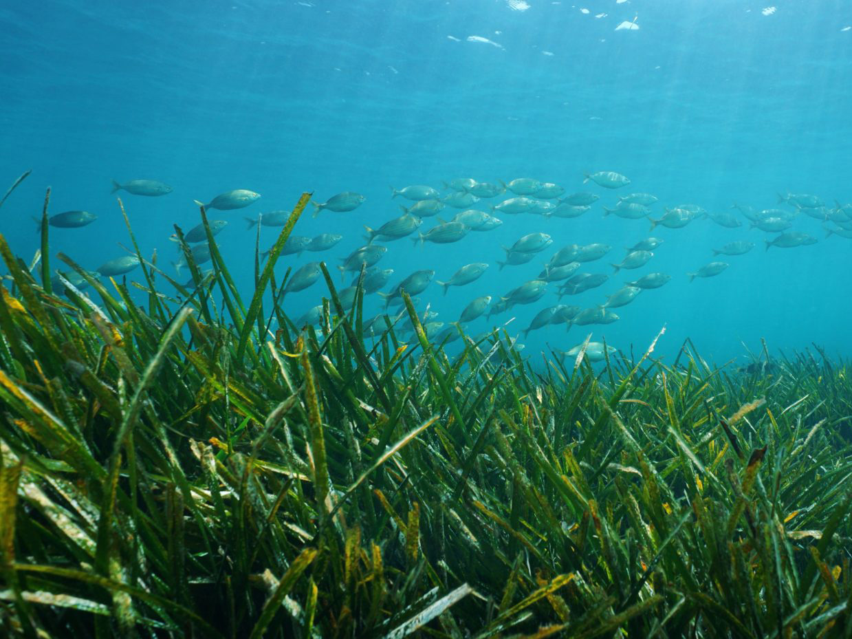
2023 Case study: Seagrass — The secret meadow under the sea
Seagrass meadows are one of the most critical natural resources in Western Port and form the beautiful secret garden under the sea.

Pest animals and weeds
Excessive grazing and digging by animals impact the type, vigour, and recruitment of plants growing along rivers and in wetlands. Grazing and wallows can physically disturb and remove vegetation. Rabbits and deer can graze so heavily that new seedling or revegetation cannot survive. Weeds can also out-compete native plants for sunlight and space, smothering natural recruitment. Untreated weed infestations result in reduced species diversity and altered ecosystem structure and function.
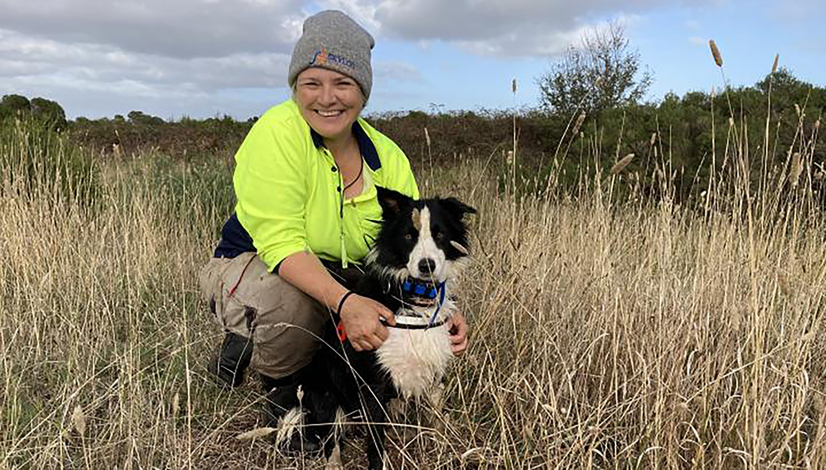
2022 Case study: Sniffing out weeds in Western Port
A collaborative and creative effort between Melbourne Water and key partners such as Parks Victoria has succeeded in controlling the invasive weed, Spartina in Western Port estuaries and coastal wetlands, using boats, helicopters and even a trained sniffer dog.
2021 Case study: A garden gone wild
Investing in protecting our native forest catchment not only protects the drinking water supply of Melbourne but is an effective way to maximises the protection of a whole range of species that occupy the forest.
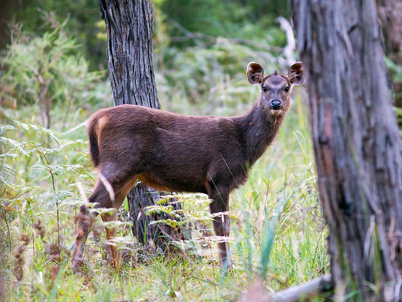
2021 Case study: Deer, oh dear!
Deer continue to be a key threat to vegetation, habitat, agriculture and safety across the region but momentum is building to tackle this pest in a coordinated way.
Actions that improve the condition of waterways for vegetation
See waterway conditions - vegetation for an outline of actions that influence vegetation.