Rivers, estuaries and wetlands support a wide range of recreational activities
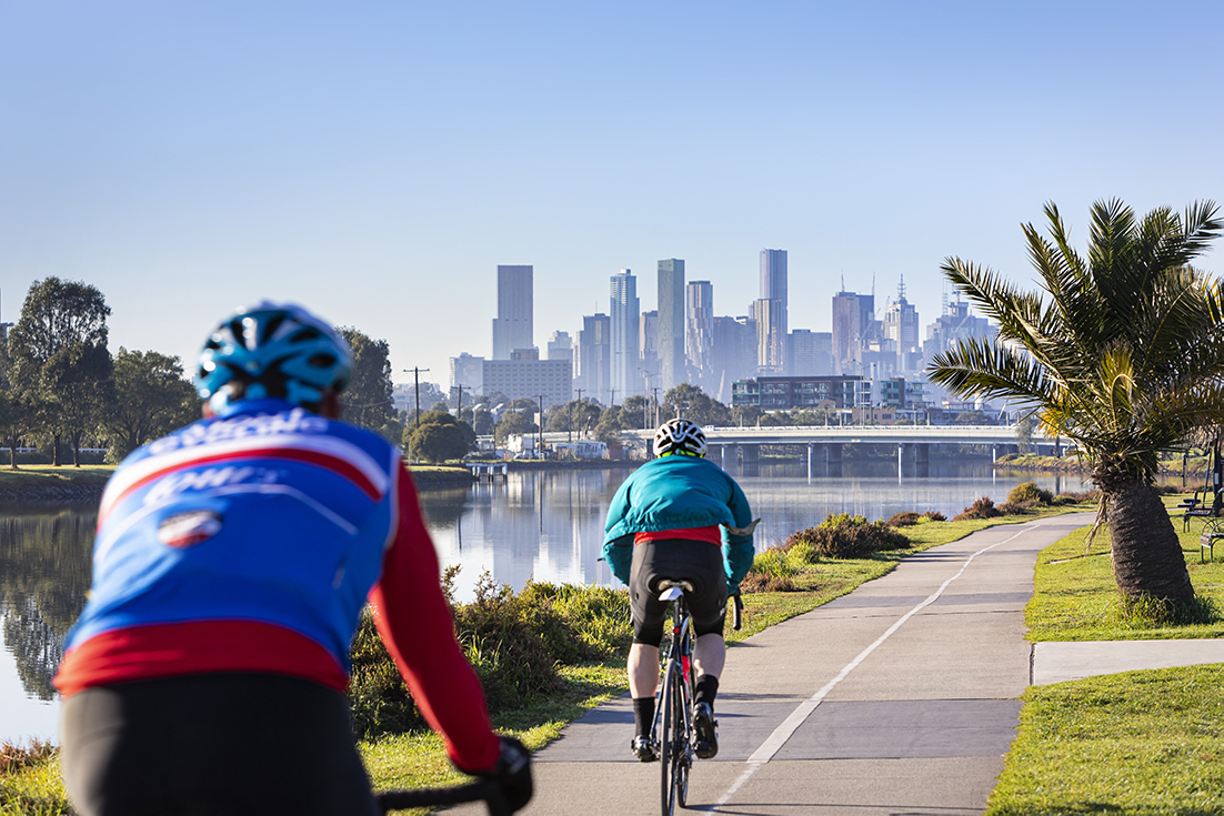
People appreciate waterways as great places for relaxing and enjoying themselves. Many rivers and wetlands have long shady paths along them which people find appealing for jogging, cycling, walking or picnicking. Paths are also commonly used for active transport to get to and from work.
Some rivers are good for rowing, kayaking, boating and swimming. Many waterways are good places for bird watching, photography and nature walks.
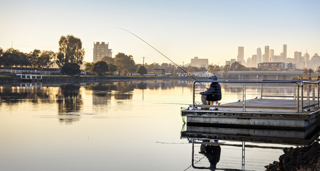
Estuaries allow people to access rivers and the coast for fishing, swimming, boating, walking and viewing wildlife associated with these waterways. There are many paths, boat launches, jetties and mooring that have been built in estuaries to enable these activities to occur.
Recreation is measured through community surveys
To assess how the community perceives the value of recreation of waterways, a region-wide survey is conducted. The survey typically samples over 2,000 individuals and ensures coverage across the region and across age and gender.
To assess the level of satisfaction with the recreation of waterways only survey participants who identify activities such as kayaking, boating, walking, cycling, fishing, swimming or bird watching as the primary reason that they visit waterways are used. Their response to the question “How satisfied are you with Melbourne’s waterways being suitable for how you use them?” is used to measure the community’s satisfaction with recreation. In addition to the survey, the recreation value for estuaries is assessed by considering the presence of facilities and activities that support recreation at these sites.
For wetlands, the limited data on recreation meant the baseline was unable to be established in 2018. The strategy includes an action to better understand social values of wetlands and this work has been initiated.
A process to review and update indicators for the social values has started. It is expected that new indicators will be implemented after the mid-term review. A region-wide evaluation of recreation will be undertaken during mid-term and final reviews of the strategy.
Recreation baseline and targets
2018 baseline: the condition of recreation was measured in 2016 through a Community Perceptions Survey.
2068 target: the target represents what can be achieved in 50 years with an increase in coordinated, collaborative and prioritised effort to manage supporting conditions for recreation such as access, recreational water quality, litter and vegetation.
Without a coordinated effort to address key conditions such as the access, recreational water quality and vegetation the level of satisfaction with recreation is expected to decline, especially as urbanisation and population growth continues.
A region-wide evaluation of recreation will be undertaken during mid-term and final reviews of the strategy.
Number of waterways in each catchment by recreation score
Hover, click or tap (on mobile) the charts below to view more information.
Baseline and trajectories in Rivers
Baseline and trajectories in Estuaries
Conceptual models show the links between waterway conditions and recreation
Conceptual models are a summary diagram that simply illustrate which conditions are most important to support recreation. Actions that can improve environmental and social conditions are linked via box colours.
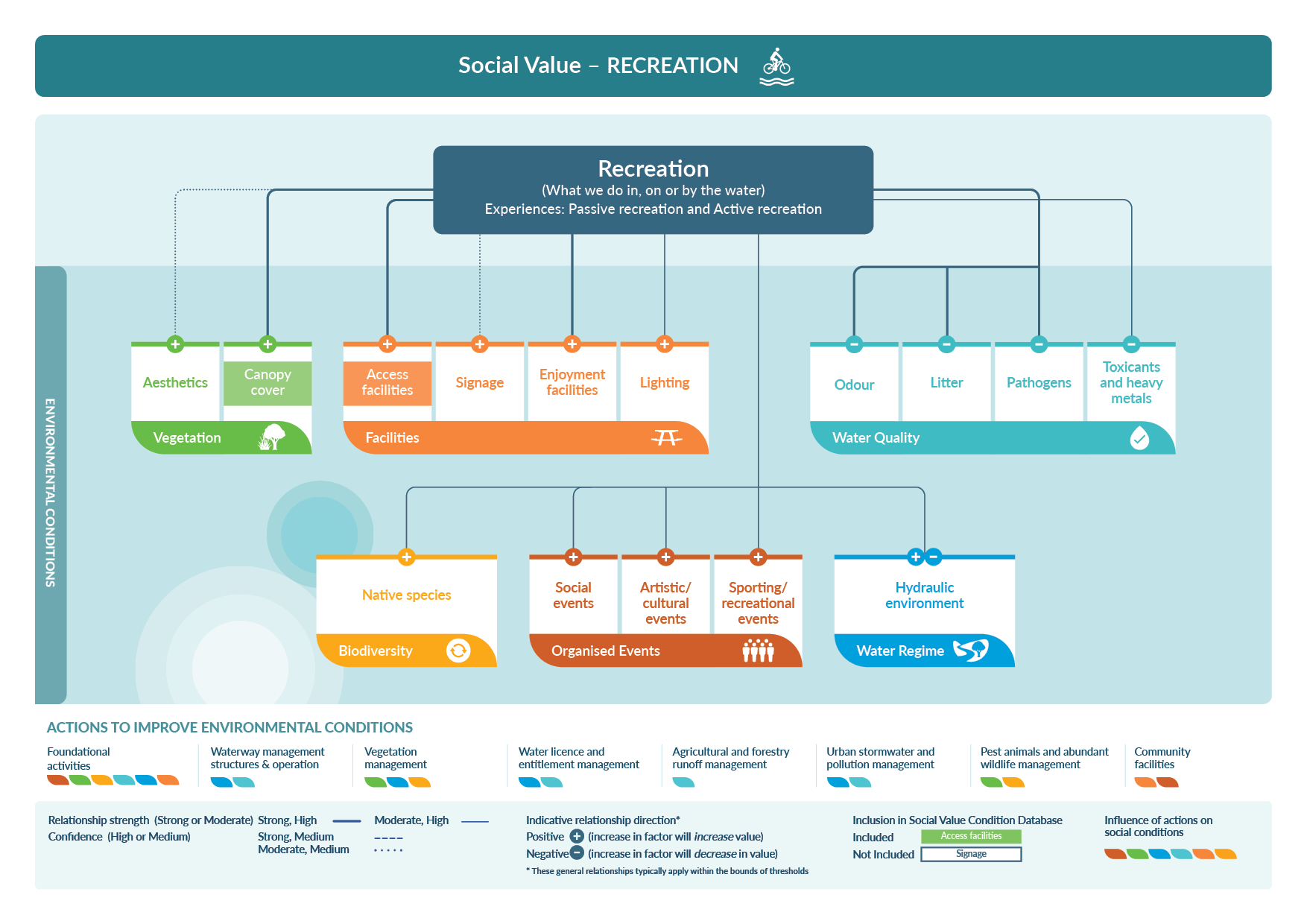
Download the recreation conceptual model (PDF 249 KB)
More information on the conceptual models can be found in the Healthy Waterways Strategy Resource Document.
Changes in waterway conditions can influence recreation
Vegetation
Vegetation is an important part of waterway recreation. Vegetation can be managed to provide views of the waterway from walking paths and lookouts, and to block views of buildings. Vegetation can influence how safe people feel using waterways and how shaded and cool the paths are for cycling or running. This needs to be balanced across the region to ensure environmental values are supported.
See waterway conditions - vegetation to see how vegetation is monitored.

Facilities and access
Facilities such as canoe and boat ramps support the use of waterways for recreation. The presence of access paths, signage and lighting enable people to get to the waterway and recreate. Provision of these facilities needs to be balanced to minimise the potential impact on the environmental values of the waterways. Some people value more natural places for recreation where access and facilities are minimised. Providing a wide range of access opportunities is required to meet the community’s diverse needs.
See waterway conditions - access for more details on how access to waterways is monitored.
Biodiversity
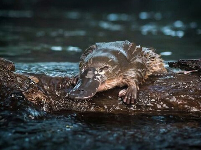
Being able to sense the presence of biodiversity such as hearing frogs and seeing birds, fish or platypus adds to the sense of appeal of an area for recreation. Some people really enjoy rowing or canoeing where they can see birds, fish and other animals. Places with high biodiversity are great places for birdwatching and nature walks.
See frogs, birds, platypus, vegetation and macroinvertebrates for more details on how biodiversity is monitored.
Participation
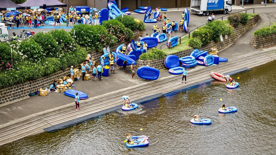
There are a huge range of events and opportunities that encourage participation in recreation. Sporting groups such as Park Run who meet beside waterways offer people a chance to connect with each other in recreation. Rowing clubs along rivers and estuaries offer members and schools opportunities to row along these waterways. Community events such as the Inflatable Regatta encourage people to enjoy water recreation.
See waterway conditions - participation for more details on how participation is monitored.
Water regime
Being able to see and hear running water adds to the sense of appeal of waterways as an area for recreation. Different flow conditions suit different recreational activities. High flow conditions suit the needs of sporting kayakers while rowers prefer the slower waters of the estuary.
See waterway conditions - water for the environment for more details on how the water regime is monitored.
Water quality
The absence of odours and litter adds to the attractiveness of waterways for recreation. The presence of microbes such as E.coli indicate the waterway may not be suitable for activities that involve contact with water.
See waterway conditions recreational water quality and litter for more details on how these conditions are monitored.
Actions that improve the conditions for recreation in waterways
There are a range of actions that can improve rivers, wetlands and estuaries to support recreation, and performance objectives are tracked annually. More information on how the strategy progress is being tracked can be found in the Report Card.
Establish buffers and maintain vegetation quality
Vegetation contributes to the aesthetics of waterways as a place to recreate as well as supporting birds and frogs that contribute to a sense of naturalness. Vegetation can provide local shading and cooling that make waterways appealing.
People tend to prefer certain aspects of native vegetation such as tall, shady trees with gaps where they can see the water. This is not what is ideal for most ecological values. Being aware of the different requirements and managing for both across the region creates a patchwork of areas that support both the social and biodiversity outcomes along waterways.
In the strategy targets have been set for extending vegetation buffers and improving vegetation quality across most of the region for rivers, wetlands and estuaries. It also has actions to support urban cooling through revegetation and stormwater management.
Improve access to enable enjoyment of waterways
The provision of paths and signs enable access to the waterway corridor. Pathways along waterways provide spaces for running, walking and cycling. Lighting helps people feel safe at night. Canoe and boat launching areas allow people to access waterways for boating and recreation.
In the strategy actions such as linking existing path networks and in new growth areas building new paths to facilitate access supports community recreation.
Enhance habitat for biodiversity
Seeing birds and hearing frogs along waterways provides a connection with nature and adds to the appeal of waterways for recreation. Habitat can be improved to attract birds, frogs and fish. Minimising human impacts to critical areas to prevent impacts on breeding is also part of enhancing biodiversity.
In the strategy actions such as protection of roosting sites for birds in estuaries and improving fish passage in rivers support habitat for the environmental values.
2023 Case study: Planting 4 Platypus
Platypus in the Diamond Creek in Melbourne’s north east are feeling the love from their local community who are working hard to improve the creek habitat.
Opportunities to participate
Organised sporting, artistic and social events encourage people to explore and recreate along waterways. Providing support for educational experiences relating to waterways helps people participate in passive recreational opportunities.
The strategy includes actions to increase participation across the region. This includes participation in relevant recreation events such as Inflatable Regatta, participation in Friends groups and in educational activities such as Waterwatch and Frog Census.
2023 Case study: Caring for Mirrangbamurn — The Maribyrnong River and Waterways Association
An integrated and living natural entity, the Maribyrnong (Mirrangbamurn) River and its catchment represents a vital element of Melbourne's ecosystem, culture, and community in its journey from source to sea. The Maribyrnong River and Waterways Association (MRWA) are a passionate community of people who are a strong, independent voice for the river they love.
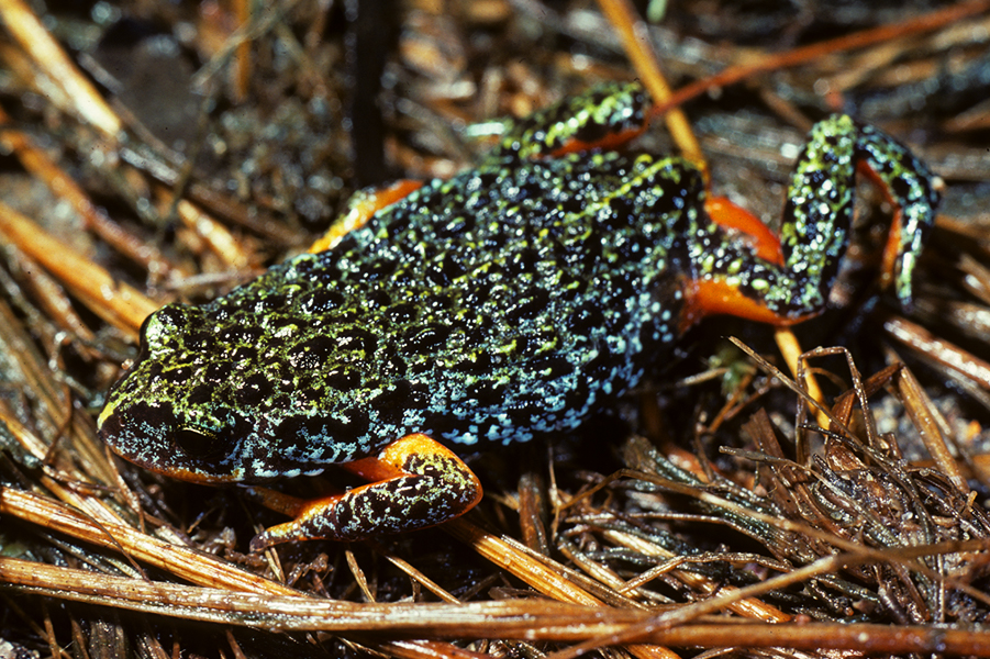
Case study: Monitoring Southern Toadlet sites across Melbourne
Southern Toadlet populations are declining across the Melbourne region. A monitoring blitz was undertaken to provide greater certainty about where populations were still present so that greater effort can be made to protect, maintain and expand these.
Improve water quality
Litter and odours detract from the attractiveness of waterways as places for recreation. Improving litter management improves the visual amenity of waterways. Odours can be improved through actions to target better stormwater management, improved water quality and flows.
Improving recreational water quality in key locations so that people can swim and boat requires a coordinated interagency approach.
Actions in the Strategy, such as reducing the impacts of septic tanks and maintaining recreational water quality will support community recreation.
See RPO-26 and RPO-27 of the Community related regional performance objectives to learn more about what's we're doing to improve litter in waterways.

2023 Case study: Collaboration is key — Tackling the tricky issue of litter together
Litter in waterways continues to be of great importance for our community. Not only is it unsightly and can entangle animals, it represents the impact that invisible pollutants in run-off can have on waterways.
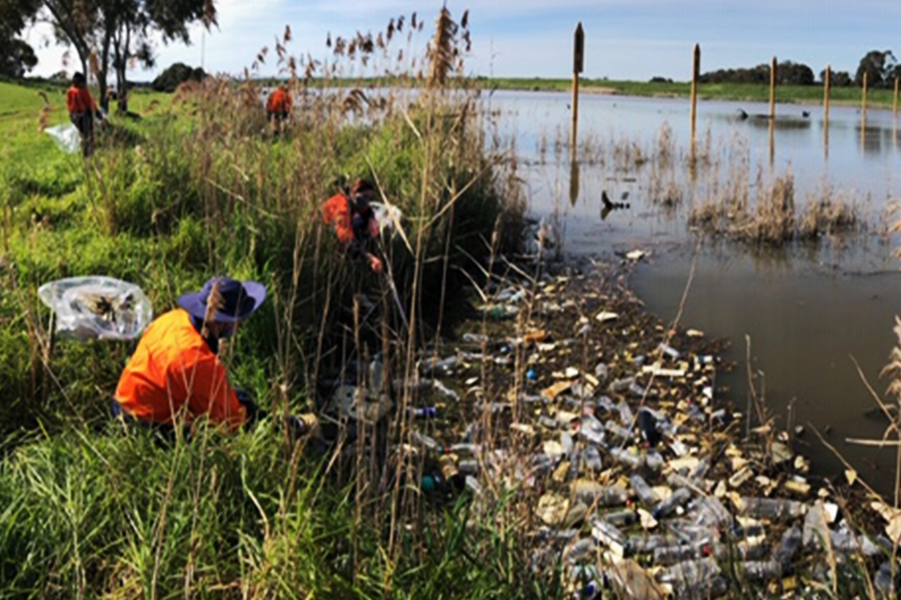
Case study: Litter Trackers — Understanding litter transport in Melbourne’s waterways
Litter is a significant problem in waterways and most of the sources of litter arise from our suburban streets. Litter tracking studies using plastic bottles with small GPS tracking devices inside collected data to show how far and how quickly litter travels through drains and waterways to the sea.