Community access underpins the use and enjoyment of waterways

Access to rivers, wetlands and estuaries is essential to enable people to visit waterways and appreciate nature, take time out from the urban environment, or participate in recreational activities.
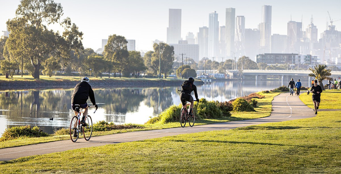
To enable community access, land along waterways needs to be publicly owned and a range of access opportunities needs to be available. Formal and informal paths support access opportunities that suit a variety of community needs. Signage can assist people to find their way and explore points of interest along waterways.
Access facilities such as launching ramps and steps facilitate safe entry to the water for boating and canoeing.
Key values supported by access
Amenity, recreation and community connection
Access is an enabling condition for all three social values: amenity, recreation and community connection. Paths enable community access to waterways for relaxation and enjoyment. They enable community events and connection at waterways. Recreation requires different forms of access including access paths, launching ramps for paddling, and linear trails for walking or active commuting. In some cases, where people are seeking an escape from the urban environment, informal paths for walking and cycling are preferred to formal paved pathways.
Improving access also needs to balance the protection of environmental values and develop the best place-based solution for the area. Managing appropriate access may also include restricting access to some waterway areas with sensitive environmental values.
Access is measured using the path network
The access metric for waterways is based on the proportion of streams with walking or cycling paths within 200m on at least one side of the waterway, as defined by VicRoads’ principle path network.
The current access metric is limited in that it does not capture informal paths, access for on-water activities, cross-over points along streams and connectivity with other paths which are considered in the planning and implementation of projects designed to improve access. Further work to determine how social values and conditions will be evaluated at mid-term will include work to improve the social values conceptual models which will help to better understand the potential metrics for access.
Access condition baseline and targets
2018 baseline: the access baseline represents the proportion of stream corridors that have accessible waterways (paths) as defined by VicRoads’ principal bicycle network.
2068 target: the target represents increasing access to streams in urban areas to 80%. This target takes into consideration constraints associated with land availability, alignment with existing open space and path strategies and a comparative assessment across the region. In less populated areas where demand is lower and it is less practical to build new paths, a lower target is proposed.
Without additional effort, there will be a lack of strategic coordination to ensure access is provided.
Number of waterways in each catchment by access condition score
Hover, click or tap (on mobile) the charts below to view more information.
Baseline and trajectories in Rivers
Actions to improve access
Increasing access to and along waterways includes ensuring public access to waterways is part of the planning for new urban growth areas. In current urban areas, it includes considering how the existing path networks can be linked through better coordination between agencies.
The Strategy includes actions that establish access along waterways in newly urbanising areas, fill gaps and improve connections and crossings to the existing path networks. For on-water recreation access requirements include increasing boat launching facilities for boating in key locations.
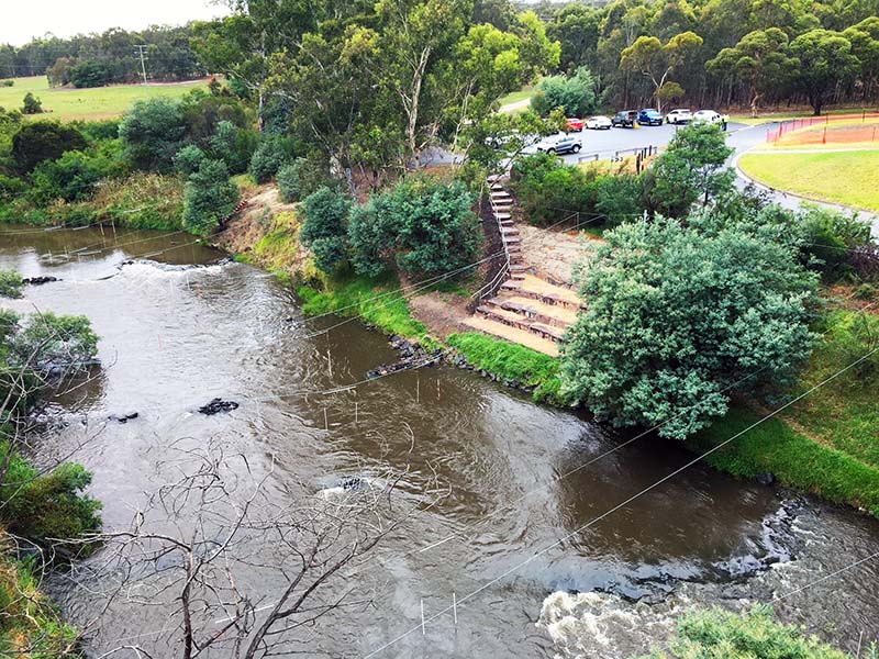
2021 Case study: Improving canoe and kayak access to the Yarra River
Improvements have been made to canoe and kayak access to the Yarra River at Westerfolds Park, Templestowe.