Improving the management of billabongs in the lower Yarra using three-dimensional imagery
The mapping of billabongs in the lower Yarra using three dimensional imagery will improve how we target actions to achieve the best ecological, social and cultural value outcomes.

“Billabongs do many things. They are the kidneys of the floodplain and river, cleansing water, storing it in the dry times and hydrating the floodplain. Many of the billabongs have been lost over the history of Melbourne and that makes those that are left all the more precious. They are the reservoirs of wildlife for the river, from the smallest creatures that drive the food chains to the plumed egrets that stalk the shadows”
Andrew Kelly - Yarra River Keeper
Important cultural and environmental features
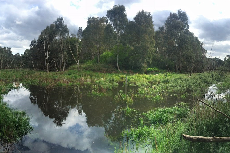
Billabongs are an important feature of the river landscape providing habitat for many plants and animals. They also have high cultural values, being an intrinsic part of Aboriginal and Torres Strait Islander peoples’ culture and society. Aboriginal and Torres Strait Islander peoples have recognised and understood how to manage water resources for a long time, and continue to contribute to the management of our water resources.
Billabong ecosystems are significantly affected by seasonal changes and the timing and extent of when they fill with water. Once there were more than 70 billabongs in the Chandler Basin of the Yarra catchment. Today, only a small number persist. Changes in flow mean the remaining billabongs do not receive the water required to sustain healthy biodiversity. This issue will be exacerbated in the future due to climate change and further urbanisation.
Using 3D imagery helps develop a landscape scale approach
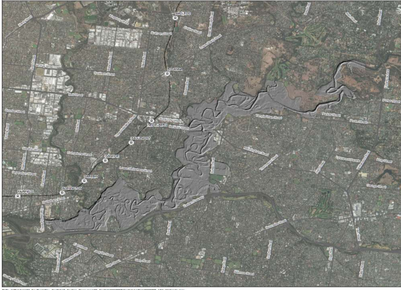
Melbourne Water has developed a process of mapping, characterising and prioritising these billabongs for potential watering through a “whole of catchment” approach using LiDAR.
Did you know?
LiDAR stands for Light Detection and Ranging and is a remote sensing technique that uses lasers to map the surface of the Earth
Through this investigation, Melbourne Water has been able to determine the volume of billabongs within the basin, characterise billabongs based on their volume and depth, and identify relationships between flow in the Yarra River and billabong inundation.

Sarah Gaskill, Environmental Water Delivery Lead of Melbourne Water says the use of LiDAR shows how the river has changed over time.
“It was the first time we’ve used LiDAR to map the capacities, volumes and the infills of the billabongs” she said.
Watch: Sarah Gaskill discusses the LiDAR billabong mapping project
So, what does this mean for environmental watering?
The outcomes of the project will improve Melbourne Water’s understanding and management of billabongs, and inform a watering program of the billabongs along the Yarra River. This process will also be useful to study other billabong networks of the Mid Yarra, Dandenong, Cardinia, Tarago and Lang Lang catchments.
Working with partners to take this further
Following on from this project, Melbourne Water worked in collaboration with stakeholders including Parks Victoria, Yarra River Keeper Association, Victorian Environmental Water Holder, Department of Environment, Land, Water and Planning and Wurundjeri Woi-Wurrung Aboriginal Corporation to develop a framework that defines visions, objectives and identifies priority sites to manage the various billabong landscapes within our region.
This project recognises these billabong sites as part of a larger, interconnected system at a landscape scale, and focuses on environmental water delivery to improve environmental, social and cultural values of billabongs.
The framework is designed to provide a stronger understanding of the individual role of billabongs in improving broader floodplain values. It will also aid in the prioritisation of billabongs to manage water regimes at other locations.